
The 1st Tokyo Smart City Liaison Meeting of FY2021
As part of the “Smart Tokyo” initiative being promoted by the Tokyo Metropolitan Government, the first Tokyo Smart City Liaison Meeting of FY2021 was held with the aim of promoting future horizontal collaboration and expanding initiatives regarding smart cities among local governments and private companies both in and outside of Tokyo, as well as raising interest in smart cities among a wide range of people. The event was held in a webinar format, with over 400 people participating, making it a very successful event.
Event Outline
| Date and Time | 2021 Monday, December 20th 13:30 – 15:00 |
|---|---|
| How it’s done | ZOOM Webinar |
Program Overview
Presentation of initiatives by local governments in Tokyo
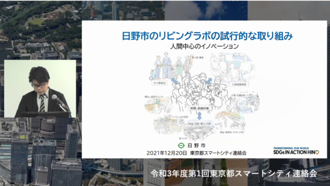
Hino City
“Hino City’s Living Lab Trial Initiative: Human-Centered Innovation”
[Speakers]
Mr. Kenjiro Nakahira, Regional Strategy Officer, Planning and Management Division, Hino City
He shared information about the city’s dialogue-oriented urban development initiatives that have been implemented in the past, as well as information about demonstration projects using living labs for healthcare and mobility, and we heard about the actual situation of urban development in collaboration with a variety of stakeholders.
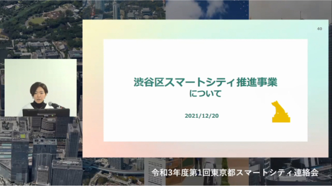
Shibuya Ward
“Shibuya Ward’s Smart City Promotion”
[Speakers]
Akane Kato, Manager of the Smart City Promotion Division, Corporate Planning Department, Shibuya Ward
[Contents]
As part of the digitalization efforts that have been undertaken since 2017, Shibuya Ward shared the status of the construction of dashboards and digital twins as part of a public-private collaboration to use data to “visualize issues,” and we heard about the status of the digitalization efforts that Shibuya Ward is undertaking across the entire ward.
Tokyo Metropolitan Government’s Initiative Announcement
“About the Tokyo Metropolitan Government Digital Twin Realization Project”
[Speakers]
Tokyo Metropolitan Government Digital Services Bureau Strategy Department Digital Shift Promotion Section Chief Naoya Shimizu Tokyo Metropolitan Government Digital Services Bureau Digital Services Promotion Department Open Data Promotion Section Chief Daisuke Motoshima
As part of Tokyo’s digital twin project, we asked about the relationship with the Ministry of Land, Infrastructure, Transport and Tourism and the Urban Development Bureau, as well as the overall picture of this year’s initiatives, including the status of roadmap discussions at the expert meeting, the dedicated website, 3D viewer, and demonstrations.
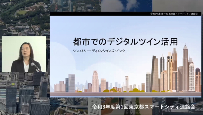
Startups’ Initiatives Presentation
“Using Digital Twins in Cities”
[Speakers]
Symmetry Dimensions Inc. CEO/Founder Shogo Numakura
[Contents]
The company shared an overview of its “Symmetry Digital Twin Cloud” and examples of how it is using cutting-edge technology, such as its efforts at the time of the Izuyama landslide disaster in Shizuoka Prefecture and its efforts in collaboration with local governments in Tokyo to consider urban development plans. We also asked about the future potential of digital twins.
Q&A List
The answers to the questions received on the day of the event and in the post-event survey are as follows. *The questions received were collated by the secretariat and answered by the speakers.
- QWhat is the city’s role in Hino City’s Living Lab and who will be in charge of the secretariat?
- A
In 2015, Hino City set out “industrializing everyday life issues” as an initiative for regional revitalization (acceleration grant), and for the first time requested matching of local issues with private companies, with Hino City acting as the coordination and secretariat. The living lab theme is an extension of this initiative, and has been undertaken on a trial basis since around 2018. In order to popularize such initiatives as sustainable activities, we believe that in the future it would be desirable for this function to be taken on not just by a single administrative organization, but by an “intermediate support organization” made up of human resources from multiple local governments, universities, etc., and for the business to be sustained. (Mr. Nakahira, Hino City)
- QIs the Shibuya Ward dashboard open to the public?
- A
We plan to gradually release the dashboard on the website scheduled to be released this year. (Mr. Kato, Shibuya Ward)
- QIs it possible to convert underground buried objects in Tokyo into 3D with the current data? If not, how do you plan to do this in the future?
- A
One of the objectives of this year’s demonstration is to confirm the extent to which there is a discrepancy between the current 2D drawings and reality. We plan to consider future policies based on the results of the demonstration. (Mr. Motoshima and Mr. Shimizu, Tokyo Metropolitan Government)
- QIs Tokyo’s digital twin being used by the Bureau of Construction in its point cloud acquisition system and when considering construction plans?
- A
The digital twin is currently in the process of being built over the next fiscal year, and has not yet been used in the operations of any bureau. Discussions are underway regarding its use in operations. (Mr. Motoshima and Mr. Shimizu, Tokyo Metropolitan Government)
- QDoes Tokyo have any plans to release 3D data as open source?
- A
The 3D digital map (3D city model) is being released as open data in collaboration with the Ministry of Land, Infrastructure, Transport and Tourism’s ProjectPLATEAU. We are also considering making the data open for future areas that will be developed (the entire Tokyo metropolitan area is planned to be developed over a period of several years). (Mr. Motoshima and Mr. Shimizu, Tokyo Metropolitan Government)
- QWhat specific efforts are you making to create a converter from the Tokyo Metropolitan Government’s 3D map format, CityGML? If there is a format to convert to, I would like to know.
- A
To promote the use of 3D city models and to encourage CityJSON to be used by the Japanese developer community, we created a Japanese manual for the English CityGML to CityJSON converter (citygml-tools) and released it on GitHub “tokyo-digitaltwin” on January 26, 2021. (Motoshima and Shimizu, Tokyo Metropolitan Government)
- QHow do you plan to cover the costs of maintaining the 3D city model?
- A
This year, the Urban Development Bureau is developing 3D digital maps of model areas in Tokyo and is verifying the operation scheme. (Mr. Motoshima and Mr. Shimizu, Tokyo Metropolitan Government)
- QWhat level of accuracy do you plan to achieve in the 3D visualization of Tokyo’s underground buried objects?
- A
We are currently testing the effectiveness of 3D visualization of underground buried objects to improve work efficiency, and plan to report the results separately around the end of the fiscal year. (Mr. Motoshima and Mr. Shimizu, Tokyo Metropolitan Government)
- QWhat is the schedule that Tokyo envisages for each local government to disclose information on digital twins by 2030?
- A
We plan to include a mid- to long-term schedule in the roadmap that will be reported separately around the end of the fiscal year. We expect that collaboration with other local governments and wards, cities, towns, and villages will take place a little further down the line. (Tokyo Metropolitan Government, Motoshima and Shimizu)
- QWho is responsible for developing the 3D city model of Minami-Osawa?
- A
The Tokyo Metropolitan Government Bureau of Urban Development and the Ministry of Land, Infrastructure, Transport and Tourism have cooperated to develop a 3D city model (3D data) of Minami-Osawa, which is now available to the public via ProjectPLATEAU. (Mr. Motoshima and Mr. Shimizu, Tokyo Metropolitan Government)
- QAre there plans to include land and building registration information on Tokyo’s digital twin?
- A
We understand that real estate registration information is being targeted for base registry development, primarily by the Digital Agency. At this stage, there are no plans to include it, but we would like to consider it as part of our collaboration with the base registry. (Mr. Motoshima and Mr. Shimizu, Tokyo Metropolitan Government)
- QHow is Tokyo monetizing its data platform?
- A
The digital twin business announced this time is a separate business from the data platform business. (Addition from the secretariat)
Although it is related to the Tokyo Data Platform project, the Digital Twin Realization Project is a separate business and we are not aiming for monetization. However, we are proceeding with the project after verifying the cost-effectiveness. (Mr. Motoshima and Mr. Shimizu, Tokyo Metropolitan Government) - QRegarding Tokyo’s digital twin, is there collaboration with other local governments or overseas? Also, are there any examples that you refer to?
- A
Last year, we conducted research in Helsinki (Finland) and New South Wales (Australia) as overseas case studies. This year, we have been fortunate to receive many inquiries from both within Japan and overseas, and we are collaborating mainly on the exchange of information. We plan to proceed with the consideration of specific data and inter-system linkages from next year onwards. For reference) Tokyo 3D Visualization Demonstration Project (Tokyo Metropolitan Government, Motoshima and Shimizu)
- QRegarding Tokyo’s digital twin initiative, are there plans to roll it out to other municipalities within the city and to other local governments, and are there any plans for how this will be rolled out?
- A
From next year onwards, we plan to consider collaboration with other organizations. We plan to make all results of the Tokyo Metropolitan Government project public, and we believe that one of the goals of our project is for each local government to make effective use of the results. (Mr. Motoshima and Mr. Shimizu, Tokyo Metropolitan Government) In addition to the digital twin, we are also working on various other initiatives to realize Smart Tokyo. (Additional note from the secretariat)
- QIn the case of Symmetry Dimensions Inc.’s efforts, what area would be necessary to use drones in the event of a disaster and create a digital twin of the damage situation within a day? (Using the Izuyama landslide disaster as an example)
- A
Currently, there is no standardization of the methods for acquiring 3D point cloud data or the coordinate systems used by each surveying company, so confirmation and modification work is unavoidable. This makes it difficult to say “how many hours it will take to process a certain number of km2.” We plan to proceed with demonstration experiments with surveying companies and local governments, and to formulate guidelines on methods and rules for submitting data in the event of an emergency disaster. (Numakura, Symmetry Dimensions Inc.)